Le Gâteau
Sport, Pedestrian sports, Hiking itinerary
in Flumet
10.2
km
3h 45min
Medium
-
Nice day hike to reach Le Gâteau in 2 1/2 hours without great difficulty. Up there, a beautiful 360 ° panoramic view awaits you.
-
Start from FLUMET, at the Tourist Office car park. Follow directions to LE GÂTEAU via Le Char, Bellevarde, Les Balmettes and Trélachat.
Return to FLUMET by going down to Le Sciozier, Le Pont de Fer, La Touvière, Le Biollay, Le Petit Biollay, Les Pontets-Morettes and Le Châtelet.
TO SEE :
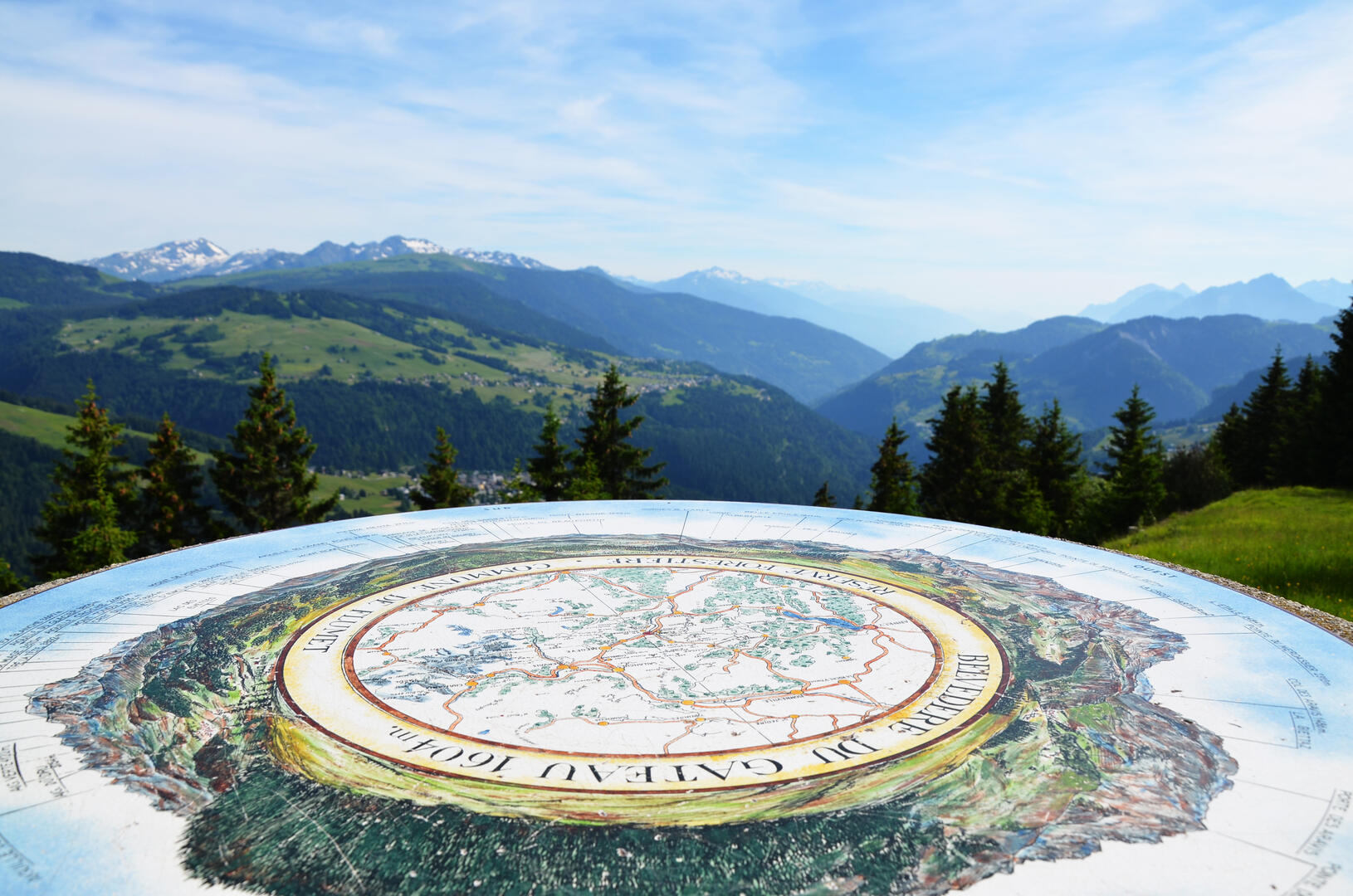
The orientation panel on Le Gâteau giving a 360° display of the peaks in the Mont-Blanc range of mountains and the Chaîne des Aravis.
INTERESTING FACT :
La Pierra Menta, which is easily...Start from FLUMET, at the Tourist Office car park. Follow directions to LE GÂTEAU via Le Char, Bellevarde, Les Balmettes and Trélachat.
Return to FLUMET by going down to Le Sciozier, Le Pont de Fer, La Touvière, Le Biollay, Le Petit Biollay, Les Pontets-Morettes and Le Châtelet.
TO SEE :
The orientation panel on Le Gâteau giving a 360° display of the peaks in the Mont-Blanc range of mountains and the Chaîne des Aravis.
INTERESTING FACT :
La Pierra Menta, which is easily recognisable because it divides the Beaufortain mountain range, is said to have been kicked there from afar by the mythical giant Gargantua when he stepped over the Aravis mountain range. The Pierra Menta mirrors the space in the rocks at the Col des Aravis.
- Departure
- Flumet
-
- Start of the trail in the parking lot of the Tourist Office, parking available.
-
-
Plain text rates
- Map of walking routes on sale at the Tourist Office at € 9.
-
-
-
Plain text period
- From 01/06 to 31/10.
-
-
-
Documentation
- GPX / KML files allow you to export the trail of your hike to your GPS (or other navigation tool)
-
Services
-
-
Equipment
-
-
-
Services
-