hiking : The Middle Balcony
Sport, Pedestrian sports, Hiking itinerary
in Notre-Dame-de-Bellecombe
10.0
km
3h 45min
Medium
-
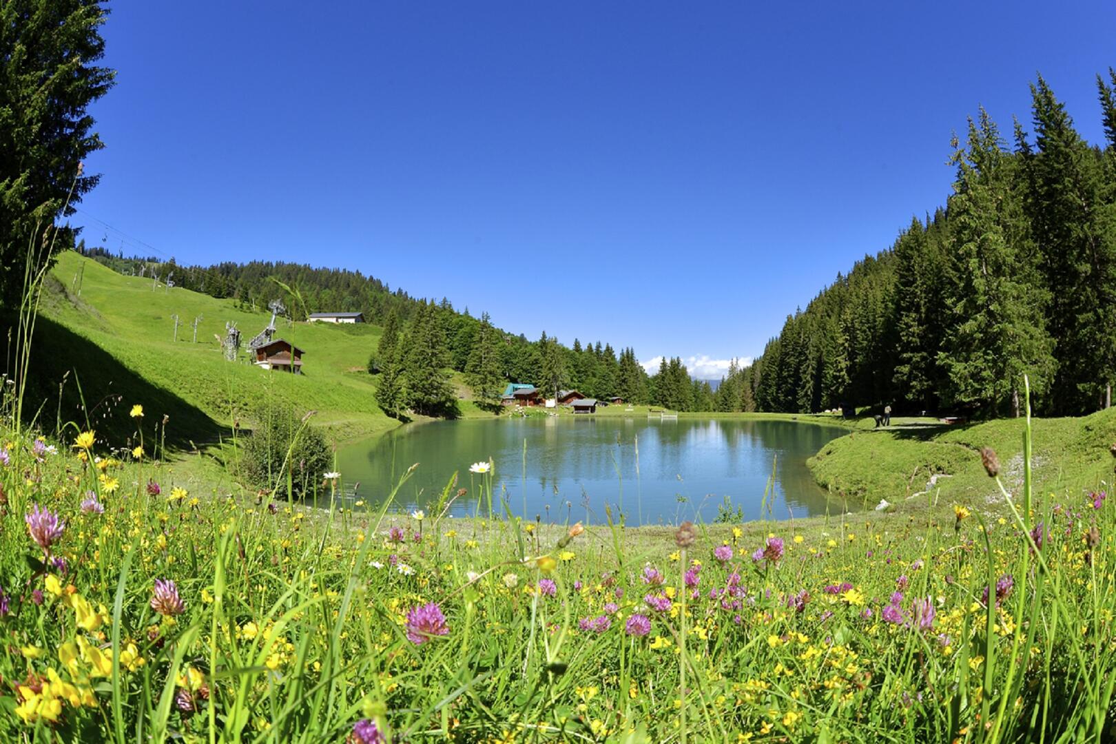
Beautiful short hike with two remarkable points: the Plan Desert Lake and the balcony path of the Horn.
-
DEPARTURE: Parking Planay.
ROUTE: from the Planay car park, follow briefly the main road and, at the garage of the ski lifts, turn left towards the COMBES. Continue on the communal road to LE CHARDONNET then right on the track to LE STOMU. Continue straight on the trail then the pleasant trail to PLAN DESERT. From there, take the track on the right which goes up to SOUS LE BOUZA then LE BOUZA. Take the track on the left and join the intersection of SUR LE TRE. Get off on the trail through...DEPARTURE: Parking Planay.
ROUTE: from the Planay car park, follow briefly the main road and, at the garage of the ski lifts, turn left towards the COMBES. Continue on the communal road to LE CHARDONNET then right on the track to LE STOMU. Continue straight on the trail then the pleasant trail to PLAN DESERT. From there, take the track on the right which goes up to SOUS LE BOUZA then LE BOUZA. Take the track on the left and join the intersection of SUR LE TRE. Get off on the trail through the forest by LA CORNE and continue on this path until the RUISSEAU DE LA CORNE. Take the track on the left towards CHEMIN DE LA PEIGNIÈRE, then on the right the municipal road towards CRET and PLANAY.
POINTS OF INTEREST:
- Lake Plan Desert, nice little lake with barbecues and picnic tables, ideal for a gourmet break!
- The chalets of Bouza, an example of the well preserved architecture of old farms.
- Departure
- Notre-Dame-de-Bellecombe
-
-
Plain text rates
- Walking and hiking map of the Val d'Arly for sale at 9 € or Topo Walks and Short hikes on sale at € 4 in the tourist offices.
-
-
-
Plain text period
- From 01/06 to 30/09.
-
-
-
Environment
-
-
-
Documentation
- GPX / KML files allow you to export the trail of your hike to your GPS (or other navigation tool)
-
Services
-
-
Equipment
-
-
-
Services
-